Special Projects
Developing location based onsite wastewater inventory
Special Projects, Bay County, MI - February.2019
Mapping Systems
Representing the location of septic systems, how we map them, is a key part of the Kawkawlin River Watershed project in Bay County. Seeing the location of septic systems on a map is a powerful visual, but we also know that location enables more powerful benefits that can help regulators manage inventories. Location provides the foundation for creating new insights and analysis opportunities, location driven reporting, data filtering and more. So, we need to carefully consider how mapping septic systems will be conducted to retain, or maximize the value of location in the Bay County inventory. Keep in mind, the mapping here is exclusively focused on older permits – new permits are currently mapped by Bay County in FetchEH.
For the Bay County project, we are using permits and their corresponding site plans as the primary source for determining where a septic system is located on a property. The problem is that permits represent location differently, so the mapping approach has to accommodate this variability. Generally, the older permits (1950 – 1990) provide less information about the location of a system compared to more recently issued permits. We have mapped several hundred septic systems at this time and have formed three general mapping approaches for permits as described below:
Permits with Final Site Plan Showing Components & Good Measurements
Permits in this category are generally more recent and produce the most accurate representation of a septic system on the map. They contain a detailed final site plan with each component mapped, two-part measurements to the components and often include features such as the taper, ports, control panels, laterals, soil boring locations and more on the final site plan and land evaluation. Measurements on the final site plan are often to the corner of a drain field or tank, or the tank riser/lid further improving the representation of the system on a map.
The result is that we can map each system component where it actually resides on the property, including all measures and system components.
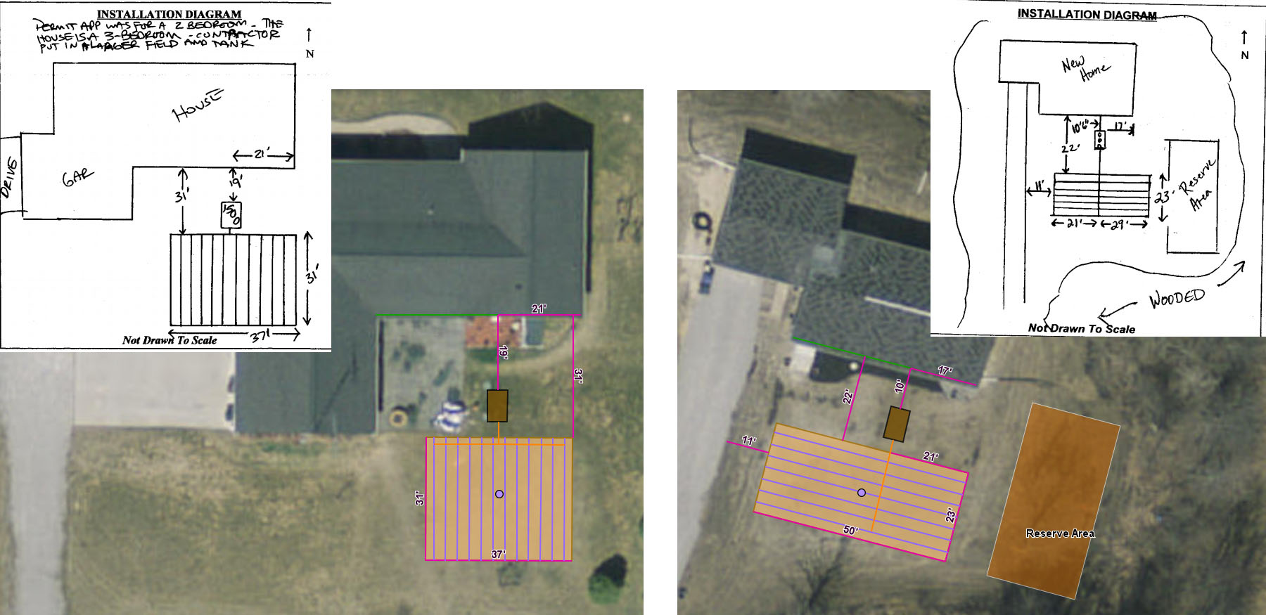
Site Plans with Components Mapped & Two Part Measurements
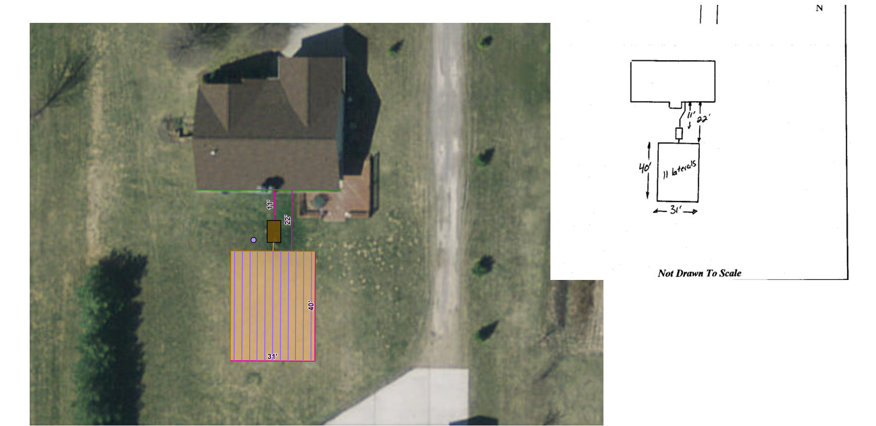
Permits with Final Site Plan Showing Components & Minimum Measurements
Permits in this category show the system components and may have one-part measures to each component. For example, a measure of 12’ from the north side of a house to the septic tank and 25’ to the side of the drain field. The key here is the lack of a two-part measurement to each feature, which means we can only be accurate in a single direction. Measurements to the drain field on these site plans are often to one side of the field, rather than a corner, further complicating how we determine location.
Mapping site plans of this nature require further evidence of where the system components are in the real world. Fortunately, we also have multiple years of aerial photography that we can reference to identify the location of the septic tank and/or drain field. Often the tank and parts of the field are evident on the imagery, and when the location of a component on the imagery matches the measurement on the site plan, we can map the components with more certainty. There are also instances where the component is very identifiable on the imagery, so we can literally see the disposal area and/or tank outline.
If there is no evidence on the imagery to support the location of system components, we move to the last option for mapping systems, which is described below.
Site Plans with Components & Single Measurements
General Location
The final category is quite broad in that it includes final site plans with single or no measurements to system components and permits without a final site plan – the location of the system is only represented on the permit, often representing the proposed location. For many older permits, the site plan does not include any measurements and often may not include a site plan sketch on the final. This makes it more challenging to map the system components, so in this case we revert to representing the system using a single point called the Permit Point.
When possible, we will evaluate the location of the system components on the permit map and/or the final site plan map and look for evidence on the imagery to verify the location of the system components. For many older systems, the location of the tank or drain field is quite evident on the aerial imagery. In these instances, we will map a Permit Point on the tank or drain field as evident in the aerial imagery.
When the location of a system can’t be verified using aerial imagery, we map a Permit Point in the approximate location of the drain field as shown on the permit map and/or final site plan map. This is the least accurate representation of the system location, but it still provides a general location from which regulators can visualize the system on a map and use the system data in FetchEH for insights, reporting and tracking.
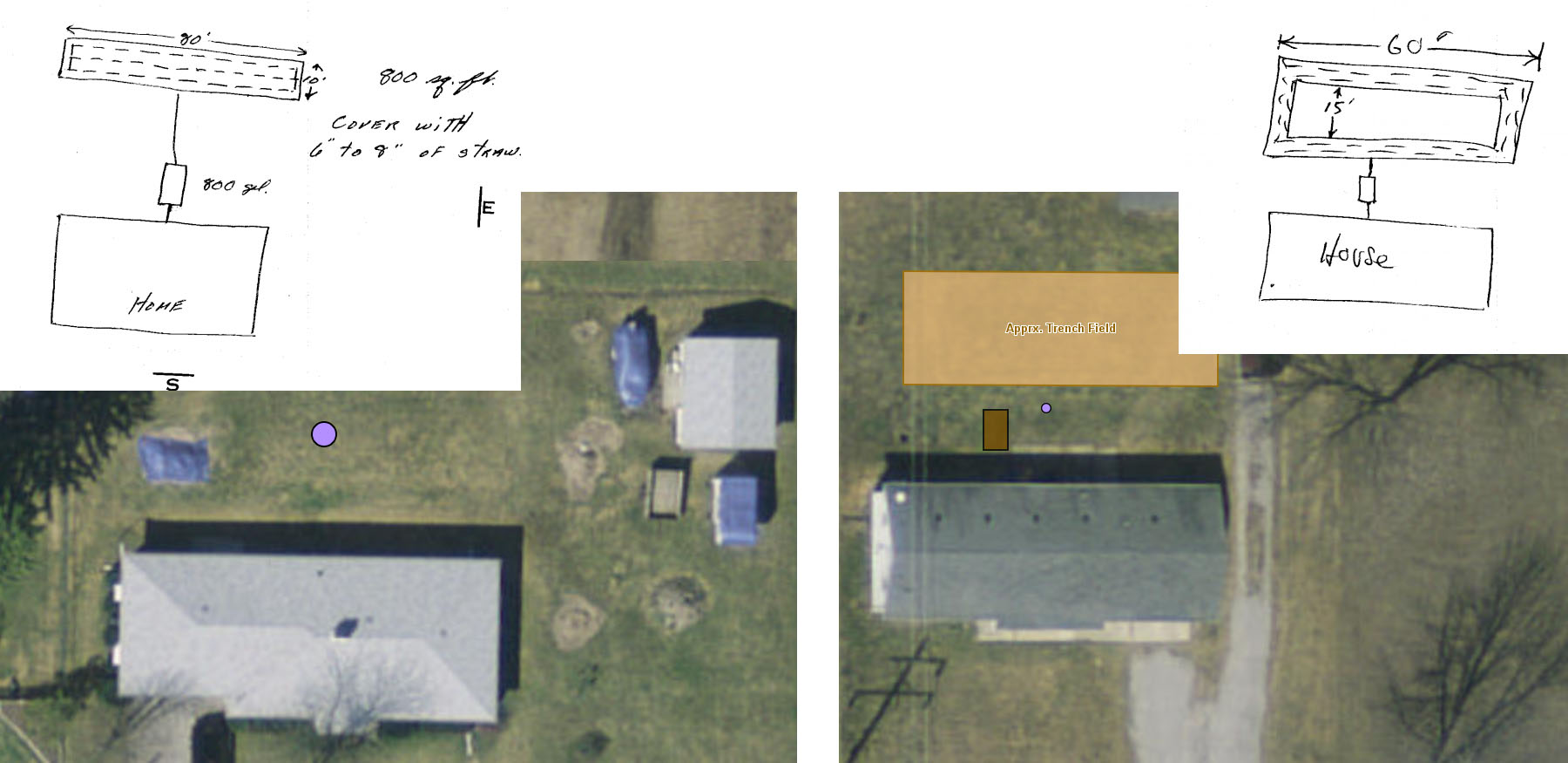
Site Plans Where Location of System is Generalized
Developing a location-based inventory has many benefits including those tied to the use of location-based software as a management tool. At a more basic level, building a location-based inventory helps regulators identify gaps in data and levels of reliability for the data that is mapped. For example, developing an inventory will result in an understanding of what parcels are not on public sewer, and do not have a system mapped – no permit on file. From a location perspective, the process will provide levels of accuracy for each system mapped, which can later be used to identify systems that need further field verification to determine what exists onsite and where.
The point is that the development process and resulting inventory produce insights and value at many different levels, and can help identify where resources need to be targeted to improve data, including location, about the inventory, which ultimately helps regulators protect water quality and public health.