Special Projects
Developing location based onsite wastewater inventory
Special Projects, Bay County, MI - December.2018
Current Data & Workflows
Our primary role in The Kawkawlin River Watershed and Education Outreach Project is to map every septic system with a corresponding permit in the watershed. Mapping septic systems and collecting information about them is data development, so like any other data development work, our initial process is to evaluate existing information (permits and site plans) and understand how this information is currently used.
We will also need to identify, and to whatever extent possible, forecast potential future uses the data will serve, but we will cover that in the next post. Understanding existing septic system information and how it is used is important because it helps define what data needs to be developed, but also how to develop it in a manner that serves existing workflows.
Existing Septic System Information
Fortunately, many of the current data collection workflows for septic systems are well defined by existing permitting processes and the resulting permit records. The permit record, digital or paper, holds information about an onsite system (site address, permit number, tank size, drain field type and size, install date, soils, etc.), in addition to a final site plan, which informs us of what was actually installed and where those system components are located on the property.
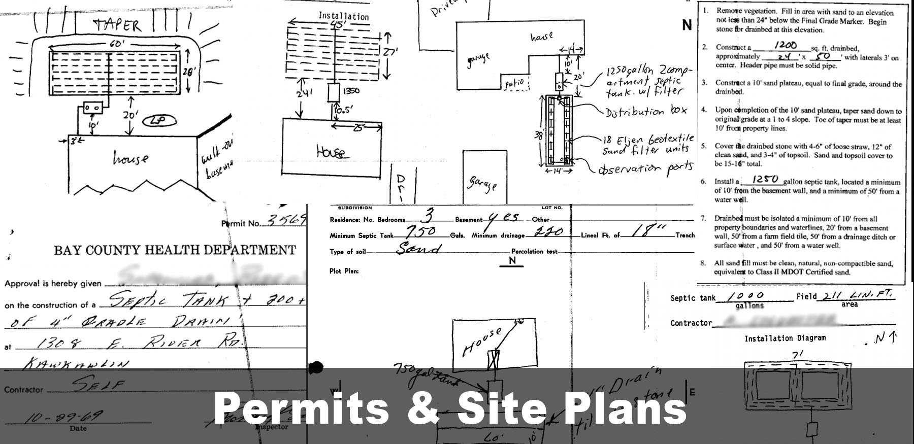
Onsite System Information Recorded On Permits
There are differences in what information was collected on a permit and how location is displayed on a site plan. These differences are largely based on when the permit was issued, but even on most older permits there is information regarding base level components, like the final inspection date, tank size and drain field type and size, and a general system location that is noted on the property. So, from the data collection side we know there is a good record of what information is captured on a permit, and that key system information is available even on most older permits.
Current Workflows
How information on a permit is currently used is also well established and can be evaluated by understanding existing workflows. Beyond fulfilling a permit transaction, permit records are most often used for reporting, tracking operations and maintenance, site evaluations and to provide septic system information to home owners, contractors, Realtors and regulators. These workflows can all be replicated and enhanced through the modernization of the data and technology.
Now that we have a better understanding of what data to develop and how it is currently used, we can transition to assessing how data might be used in the future and the role the technology plays. In the next post we will evaluate software design to make sure it supports data development, and that it provides the tools required to support both existing workflows and potential future uses of the data developed during this project.