EH Bellman
Location, data and EH. A better way forward.
EH Bellman - July.31.2017
The Case For Good Data
Estimates vary, but a common figure puts the number of septic systems in the U.S. at around 26 million with approximately 10 – 20 percent of these septic systems failing. Many areas in the U.S. have reported even higher failure rates, highlighting the need to understand more about the health of septic system inventories and develop effective strategies to reduce failure rates in our communities.
Yet understanding the true nature of the problem, and targeting programs and funding to mitigate systems most at risk of failure remains challenging for regulators. The problem is complex and multifaceted, but a contributing factor is the lack of good data about septic systems. The lack of good data makes it difficult for regulators to better understand the problem, but it also limits how data is used to identify at risk systems and address problems before failure occurs.
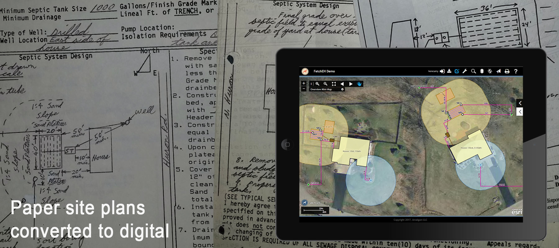
Moving From Paper Records to Digital
What Is Good Data
Good data should start with the basic premise that it is digital, but this is a very low bar to set. Often a scanned PDF site plan and permit is considered digital, yet these digital records have little value beyond record keeping. Permit records in a database are digital, but in many communities these records are not complete with a significant amount of the septic system inventory remaining on paper in a filing cabinet. Permit databases do not represent the location of a septic system on a property, which limits using location for map visualizations tied to reporting, filtering and insights.
System data includes digital permit, inspection and maintenance records about septic systems. It should be complete and offer system variables like age, tank size, drain field type and size, maintenance records and more. Enhanced location data simply means that the data should provide the location of the system on a property, whether a full digital site plan or a point representing the onsite system location.
Location Based Onsite System Data
Location based onsite wastewater system data allows regulators to see what is happening in their community. This includes using routines like reporting, filtering and map visualizations to gain useful insights about onsite systems, improving operational efficiencies and to communicating information more effectively to other regulators and the public.
Onsite system data that is managed using location also provides the opportunity to use other location data, such as soils, other onsite systems, wells and more to assess and manage onsite systems. This includes simply reviewing other onsite systems and wells in when permitting a new or replacement system, but can also include more complex routines to understand density, proximity and coincidence of features to each other. Location allows us to visually connect with information and gain a new perspective, one that is not possible viewing information on paper or in a database.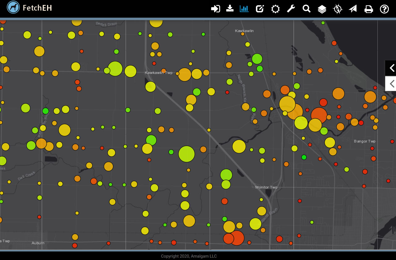
Using Location To Visualize Onsite Wastewater Data
Developing good onsite system data is the key to using that same data to help protect public health and water quality. Good data should be designed to serve your needs - to work for you, including enhancing workflow/operational routines, improving access to onsite system information and to help answer questions about onsite systems. Good data is an essential building block for understanding more about your onsite system inventory and implementing informed, data driven decisions that help improve the health of onsite systems in a community.
More Posts