EH Bellman
Location, data and EH. A better way forward.
EH Bellman - June.29.2019
Developing a Location Based Onsite Inventory
We talk a lot about the value of a location-based onsite wastewater inventory and how it can be used in FetchEH to gain new insights, improve access to information and to help regulators manage systems in their communities. The value side is certainly important, but we can’t add that value without first going through the process of actually developing a location-based inventory.
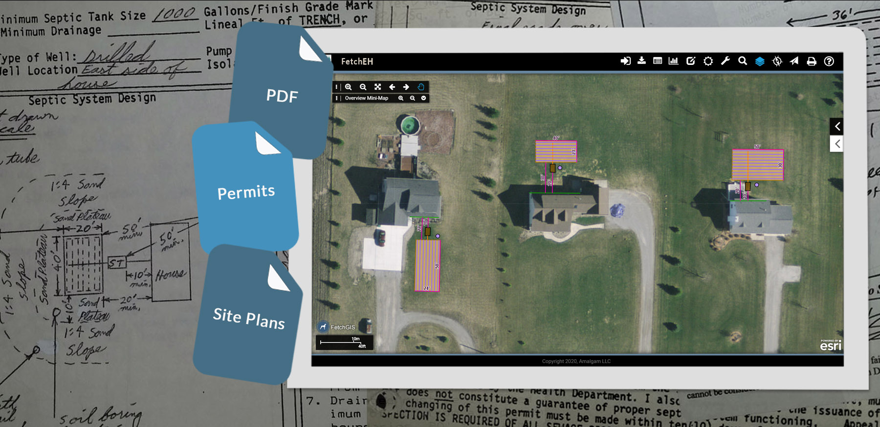
Convert Scanned/Paper Onsite Permits
For many of our clients, developing an inventory starts with a need. Often this includes improving workflows and data through modernization as a core concept, but it also extends to supporting existing or newly adopted regulations, enhancing access to onsite data and transitioning to an environment where onsite data is used as a management tool. In general, the development process starts using one or more of the following approaches:
This Point Forward
The this point forward approach starts by mapping all new, replacement and repair permits as it is relatively easy to integrate with existing workflows. As time permits, older systems are mapped, often aligning with an objective such as mapping a watershed, lakeshore or areas with poor soil conditions. This approach results in a long-term development cycle, but it has also been used to justify additional funding to expedite mapping, especially as the inventory grows and visualizations, reporting and insights are generated as returns.
Regulatory
The regulatory approach is often initiated because new regulations have been adopted, such as operations and maintenance (O&M). Because the regulation requires that all systems be inspected at some frequency, it makes sense to map systems when they are inspected or when maintenance is performed. This approach also leverages O&M tracking in FetchEH, so organizations benefit from visualizations, reporting tools and insights related to O&M data. Organizations that use this approach also map new, replacement and repair permits.
Third Party Partnership
Partnering with a vendor or non-profit organization to develop your inventory is one way to expedite the development process. The key here is that a funding source(s) is required, which can come from local sources, grants or some combination of both. For example, we recently started a project with the Bay County Health Department (Michigan) to develop a complete location-based inventory (learn more about the Bay County project here). In this case, the mapping is part of a larger watershed grant where the results will be used to better understand the composition of onsite systems in the watershed. Based on conversations with clients and others, we believe that this approach, especially if grant funding can offset or pay for all of the mapping, will become much more common and accepted at all levels of government.
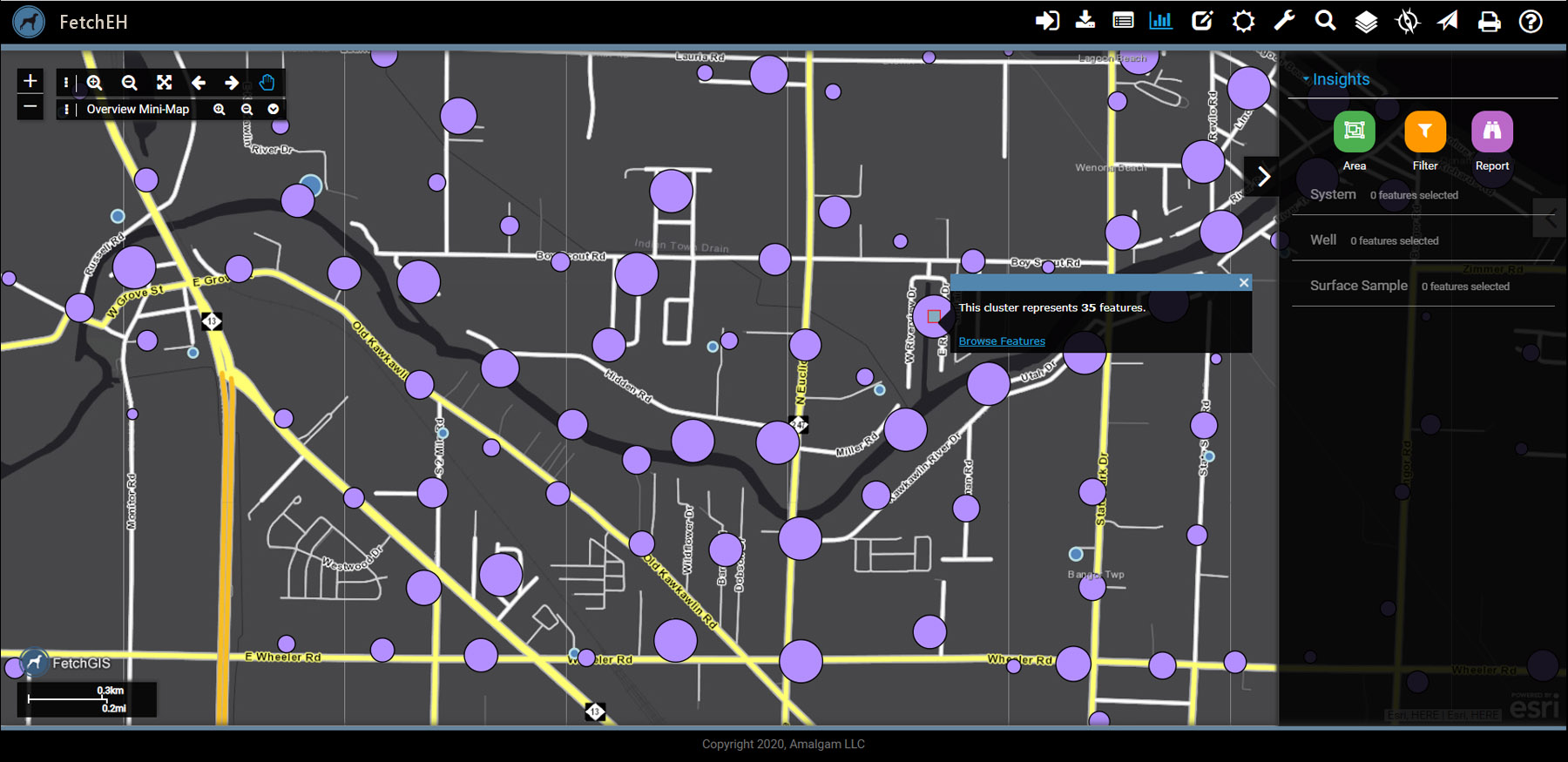
Mapped System Points
Developing a location-based inventory can start using any of these approaches and often evolves to include more than one approach. For some clients the development cycle is a long-term effort, while others are seeking grants and local funding to help expedite the development process. The important thing is simply to get started – once systems show up on a map the benefits are much easier to see by decision makers and others that you need support from.
More Posts